About Us
History
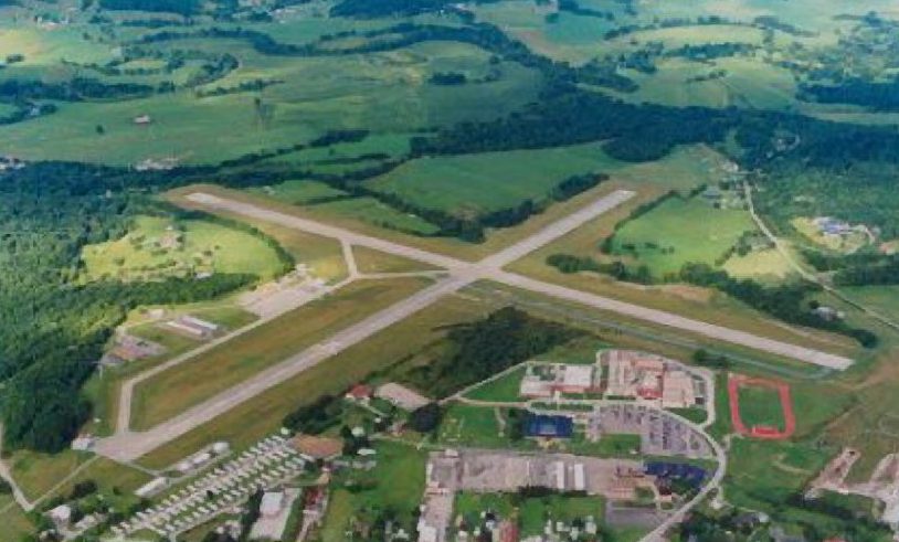
The Elkins-Randolph County Airport is located two miles south of the city of Elkins. The airport was built in the 1930s. In the early days of airmail service, mail was picked up by stringing a wire line between two poles while an aircraft caught the wire on a hook as it flew overhead. The mail to be delivered was then dropped as the aircraft departed. During World War II the airport was used as a US Army Air Corps training base. The cadets were housed in the Halliehurst mansion at Davis and Elkins College. The airport was also used as an evacuation facility for east coast military bases during hurricanes. At those times the airport would be wingtip to wingtip with warbirds.
Lake Central Airways, a predecessor to US Airways, began passenger air service using DC-3s. Even though it changed hands several times, this service continued until 1994.
Being on one of the early airways crossing the country, Elkins has seen a wide range of navigation facilities, beginning with the lighting of fires at night to guide pilots. Later, Elkins became a site on the Airway Beacon System. (The last of which is still operating on Rich Mountain west of the airport.) Then came the Low-Frequency Radio Range, which was located two miles north of the airport, the Randolph County Non-Directional Beacon (NDB) located on the field, and then the Elkins VHF Omni-Directional Range/Tactical Air Navigation (VORTAC) 11.4 miles to the west. Elkins is currently served by several instrument approaches including three Global Positioning System (GPS) approaches.

Authority Meeting Dates
Airport Authority Meetings are held the second Tuesday of each month at 5 PM in Airport Terminal Building
- January 9, 2024
- February 13, 2024
- March 12, 2024
- April 9, 2024
- May 14, 2024

